New city record set for warmest, driest winter in Syracuse since 1950
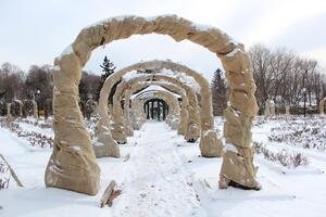
In the midst of a record-breaking dry winter, Syracuse has yet to experience its average snow accumulation. Last weekend brought only the citys second snow storm.
For Central New York, the winter of 2011-12 has exhibited warmer temperatures than usual and has proved to be one of Syracuse’s least snowiest since 1950.
The National Weather Service began measuring the snowfall at Hancock International Airport in Syracuse in 1950. Since then, the previous record for least amount of snowfall by Jan. 10 was set at 14.3 inches in 1966. This year, the city’s seasonal snowfall totaled only 12.9 inches by the same date, according to an article published by The Post-Standard on Wednesday.
This contrasts with last winter, which was the fourth snowiest season for Syracuse with a total of 173.5 inches falling. Syracuse University had classes canceled due to snow when a total of 13.4 inches fell overnight.
In the United States, from December through the beginning of January, mild temperatures have been a trend throughout the country, according to a Jan. 9 Time magazine article. In December alone, about half of the country had temperatures that were at least 5 degrees above normal, according to the article.
By the end of 2011, less than 20 percent of the United States was covered with snow, compared with more than 50 percent at the end of 2010, according to the article.
Cathryn Newton, dean emerita and professor of interdisciplinary sciences in the College of Arts and Sciences at Syracuse University, said one season cannot determine a trend of a warmer Earth. Many years must be taken into account to confirm the atmosphere is getting hotter.
Newton moved to Syracuse from California 29 years ago. She said her first winter in Syracuse was one of the driest and warmest in a long time due to the northward movement of the jet stream, which gave the city a less severe winter. This winter is even drier in terms of snow than 1983, she said.
Jet streams are rivers of wind high in the atmosphere and control where winter storms take place and retreat northward during unusually mild winter weather, according to an online article published by USA Today.
The cold arctic air was kept from pushing into the United States because the jet stream pattern in December was the most extreme on record, according to the Time article.
Newton said she, and most modern scientists, agree the Earth is on a warming trend. She said this is most evident when studying the frequency of extremes in our area. In the last 30 years, she said, Syracuse’s winters have produced the highest amounts of precipitation in history, and many of the warmest years on record have been in the last decade.
But Newton said more snow does not mean colder weather. The lakes around Central New York and the Great Lakes are staying temperate as the atmosphere becomes warmer and heats the water’s surface. This allows air moving over the lakes to pick up more moisture, which means the Syracuse region is likely to have more snow, Newton said.
‘But there is no way to tell what next year will be like from the character of this year,’ Newton said.
Weather is described as what happens on a day-to-day basis, but studying the climate is based on decades. Keeping this philosophy of study in mind, it is true that cold temperatures are becoming less common in this country, with every year’s annual temperature becoming higher than the long-term average since 1980, according to the Time article.
Published on January 16, 2012 at 12:00 pm